shall we swim today?
Note
This is a work-in-progress. Please don't take it too seriously yet. The
goal is to provide a rough estimation of what the current is doing at a
given time, and to illustrate it in a helpful way.
Feedback welcome.
Change the time:
-1 hr
now
+1 hr
Current Prediction
At Thursday, April 10 at 5:01 AM, we estimate the current is
flooding at 1.1 knots and is getting weaker.
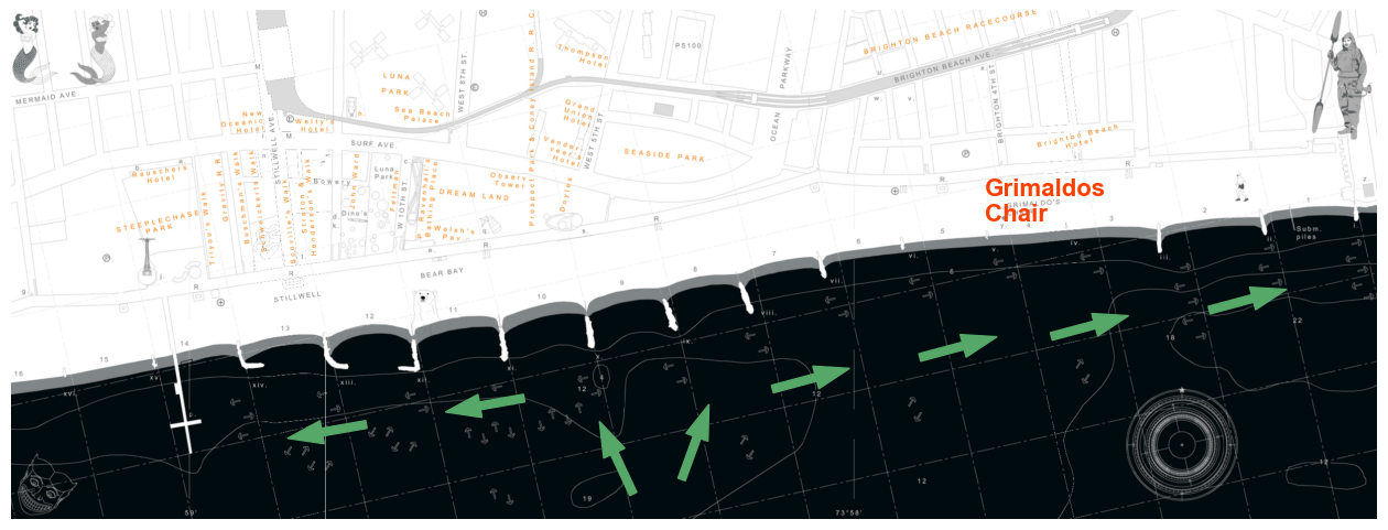
An incoming flood tide will be going from west
to east at Grimaldos Chair
Current map

The size of the arrows approximate the strength of the current
Tide Current Projection
 The currents here lead the tide by about 2 hours. The max flood
current is 2 hours ahead of high tide, and the max ebb current is 2 hours
ahead of low tide.
A positive current value (above green dashed line) indicates the current is
flooding. A negative current value indicates the current is ebbing.
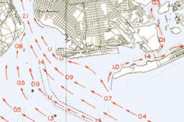
Legacy Map - 5 Hours after Low Water at New York
Many years ago, the US Deptartment of Commerce published hourly tides for
the NY harbor. This is the most closely matching chart, as it is
4.5 hours since the last
low tide.
Where do the current estimates come from?
There are two relatively nearby NOAA current prediction stations at
opposite ends of the waters off Coney/Brighton, which gives us a ebb/flow
curve. We then take a mean of those predictions to estimate the current in
our local swimming area. Note that this just provides a predicted current
speed and ebb/flow. The actual direction shown here is based on local
knowledge (and could be improved still!). In the absence of a closer
current prediction, this seems the best approach.
NOTE! The current at our beach effectively reverses near the Aquarium (see
the map). The direction of the current near the pier will be the opposite
of the current at Grimaldo's.
This is an overall estimate for the area. Since it is based on NOAA
current precitions, it accounts for moon phase and lunar tidal cycles.
However this can not account for wind or local effects, e.g. jetty
interactions.
How is this useful?
Generally you should swim into the current at the start of your swim when
you are fresh, so that you will have an easier time on the return trip.
Longer swims that occur near a tide flip may want to take that into
account...so the first half of the swim is with one part of the tide (e.g.
ride the flood eastward to Manhattan Beach), and the second half will take
the opposite (e.g. riding the ebb on the return).
Sources
 The size of the arrows approximate the strength of the current
 The size of the arrows approximate the strength of the current
